Coastal Adaptation Plan – Fraser River Foreshore
Coastal Adaptation Plan – Fraser River Foreshore
Client: City of Vancouver
Date: 2017 – 2018
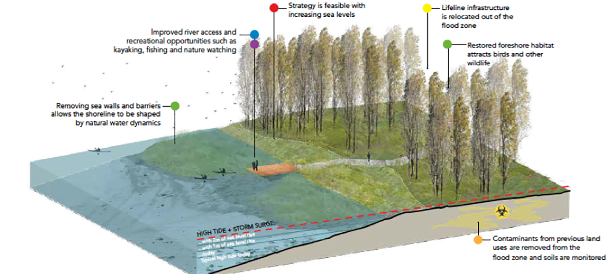
EcoPlan led a project with support from Northwest Hydraulics Consulting (NHC) and Connect Landscape Architecture on the City of Vancouver’s Coastal Adaptation Plan. The project explored the City’s most at-risk coastal flood hazard areas, the Fraser River shoreline, to engage affected communities and businesses to gather input on values, guiding principles, and potential flood management options. The outcomes of this stage will help develop criteria that will be used by the City and landowners when developing potential flood management strategies and infrastructure.
Using a participatory, values-based approach, the first phase of the project engaged residents and other partners, including Musqueam First Nation. Multiple rounds of community and partner engagement events were organized, including an asset owners’ workshop, Musqueam staff and community workshops, as well as various community-wide workshops, open houses, and surveys. In addition, EcoPlan also developed a Sea Level Rise Primer for the City. The Primer was a foundational communications and awareness building piece that will support future phases in two other principal coastal flood risk areas – Jericho-Spanish Banks, False Creek, and the Flats.
This project was recognized with a 2019 Planning Institute of British Columbia Excellence in Planning Award (Gold) in the Research and New Directions in Planning category.
[table id=16 /]